

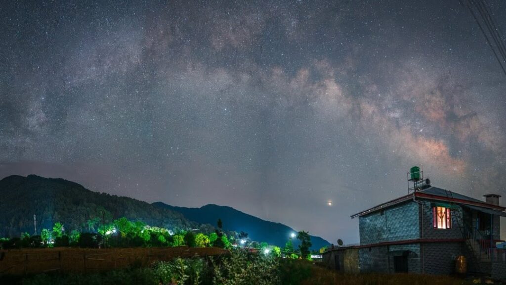
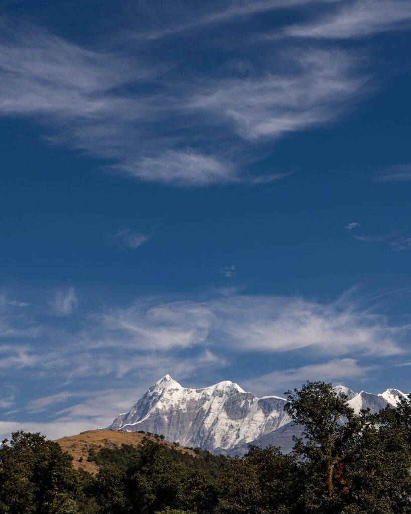
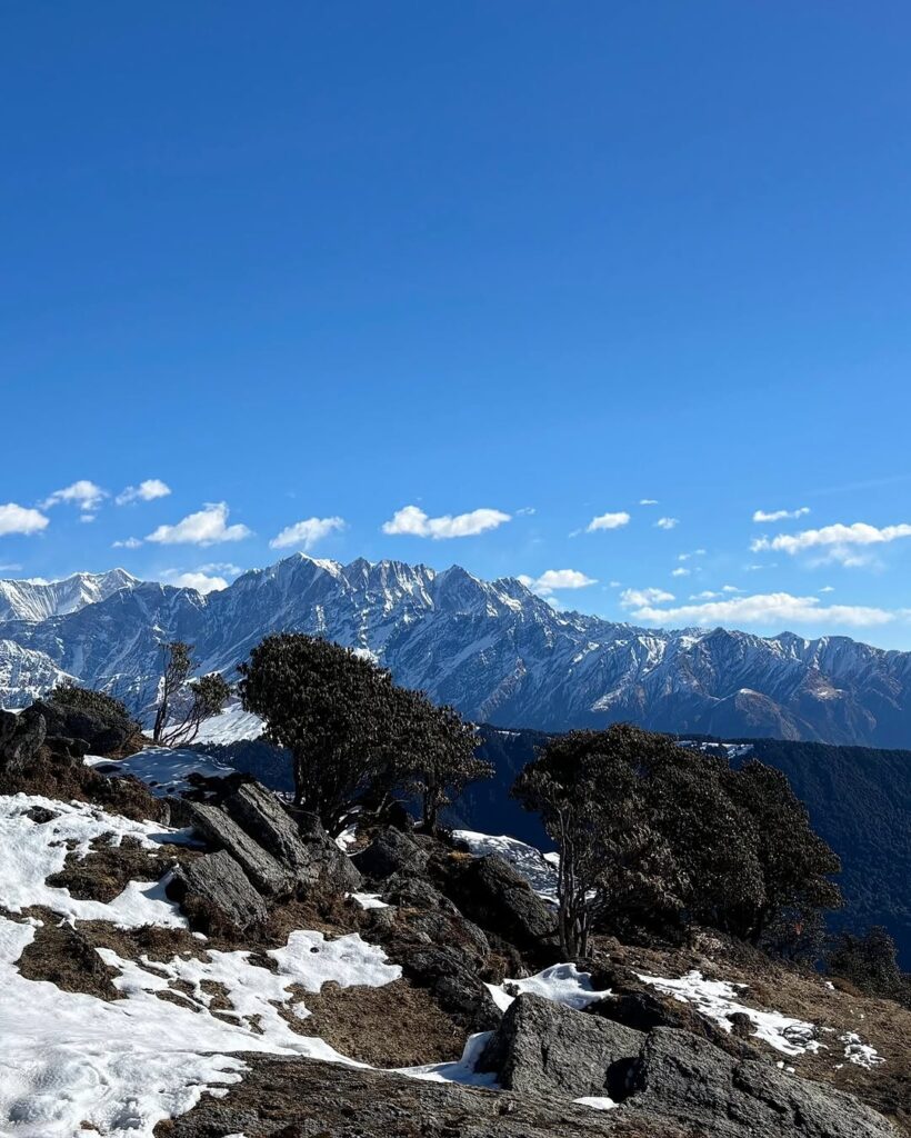
Brahmatal, The trek takes you to the serene and frozen Brahmatal Lake, which is believed to be the meditation site of Lord Brahma.
Brahmatal Trek is the truth that our Uttarakhand Dev Bhumi is said to be the reason that Gods have done severe penance here, so wherever you go in Uttarakhand, you will definitely hear the stories of Gods and Goddesses.
Brahmatal Trek is also a violence of the same story, people here today have their faith in this pond, Brahmatal is a beautiful lake that starts from the Lohajung base camp of Chamoli district of Uttarakhand Himalayas, The height of this trek is 12,250 feet, the trek here is of a moderate level trek, this trek is a good trek for the first time trekkers.
Here the trek starts from Dehradun via Rishikesh ; this trek is about 5 nights 6 days. In this trek, we complete an elevation of about 4,678 feet from Lohajung to Brahmatal in 2 to 3 days, With Brahmatal, in addition, Bekaltal is the attraction of this trek; so, explore these two pristine glacial lakes and enjoy camping beside Bekaltal frozen shores. The sight of these two will surely feast on your eyes because of its heavenly natural beauty.
Itinerary
- Total distance 290 km – 9/10 Hours journey
- Mode of journey – By taxi
- Altitude – Lohajung – 2316 Meter
- Night stay – Our Home stay – on twin/three share basis
The journey from Dehradun via Rishikesh to Lohajung is 09-10 hours long, there will be one or two breaks in which you can have your breakfast and lunch en route.
- Dehradun to Rishikesh: As you leave Dehradun, you’ll travel through a mix of urban and suburban areas. The road is well-paved and offers views of the Shivalik hills and the Ganges River. Rishikesh, known for its spiritual significance, is your first major stop. You might see temples, ashrams, and the iconic Laxman Jhula bridge.
- Rishikesh to Devprayag: The road continues to wind through the hills as you head towards Devprayag, where the Alaknanda and Bhagirathi rivers converge to form the Ganges. This is a particularly scenic stretch with lush greenery and glimpses of the flowing rivers.
- Devprayag to Rudraprayag: The road continues to follow the Alaknanda River upstream. You’ll pass through Rudraprayag, another confluence of rivers, where the Mandakini River joins the Alaknanda. The town is situated at the base of impressive mountains.
- Rudraprayag to Karnaprayag: The road continues to ascend, and you’ll pass through Karnaprayag, which is yet another confluence point, this time of the Alaknanda and Pindar rivers. The terrain becomes more mountainous and the air crisper.
- Karnaprayag to Tharali: The journey takes you through charming mountain villages, and you’ll get to enjoy the panoramic views of the surrounding peaks. Tharali is known for its natural beauty and is surrounded by lush forests.
- Tharali to Lohajung: The final stretch of the journey takes you through winding roads that offer breathtaking views of the Himalayan peaks. As you approach Lohajung, you’ll notice the landscape transitioning into a more alpine environment. Lohajung is the base camp for the Brahmatal Trek and is surrounded by stunning mountain vistas.
Reach Lohajung and today have your dinner and stay at a tourist rest house.
Total distance 06 km – 4/5 Hours journey
Mode of journey – On foot 06
Altitude – Bekaltal – 3012 Meter
Night Stay – Our Camp – on twin share basis
The trek from Lohajung to Bekaltal is a popular route in the Uttarakhand region of India. Here’s some general information on the route:
Route Overview:
- Starting Point: Lohajung
- Destination: Bekaltal
- Type: Moderate trek
- Distance: Approximately 06 kilometers (5-6 miles)
- Duration: Usually takes around 4-6 hours, depending on individual pace and conditions
Route Description:
- Lohajung to Bekaltal: The trek begins from Lohajung, which is a common base for several treks in the region. The trail initially passes through forests and gradually ascends. You’ll likely encounter lush greenery, streams, and occasional clearings offering beautiful views of the surrounding mountains. The path is relatively well-marked, but it’s advisable to have a local guide or a good map for navigation.
Overnight Stay/Camping:
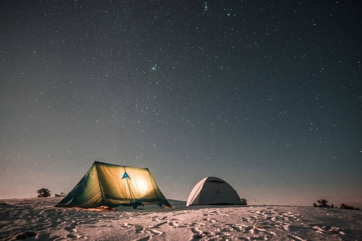
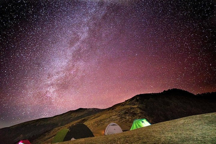
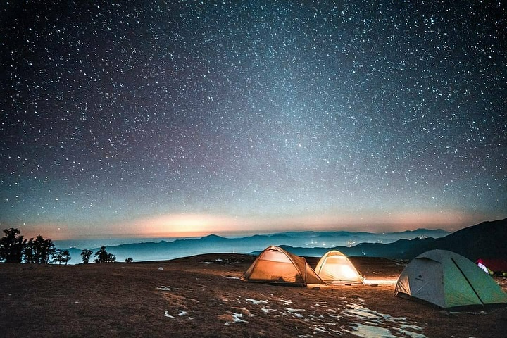
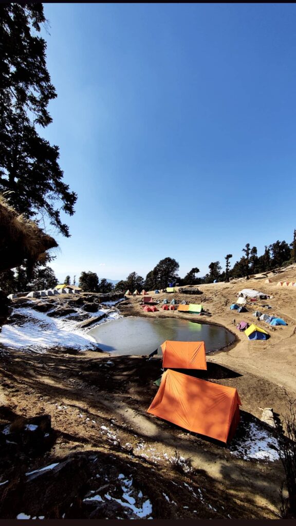
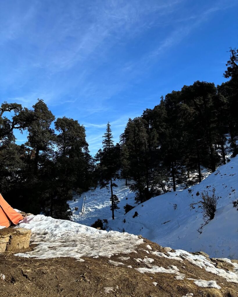
- Bekaltal offers a serene camping spot amidst the mountains and is often chosen as an overnight stop for trekkers. There are camping grounds available where you can pitch your tents. Make sure to carry appropriate camping gear, including tents, sleeping bags, and cooking equipment if you plan to stay overnight.
Route View and Map:
- View: The trek offers stunning views of the Himalayan ranges, including peaks like Nanda Ghunti and Trishul. You’ll also encounter pristine alpine lakes, dense forests, and meadows along the way.
- Map: Detailed topographic maps of the region can usually be obtained from local trekking agencies or tourist information centers. Additionally, there are trekking guidebooks and online resources that provide maps of the route.
Location:
- Lohajung: Lohajung is located in the Chamoli district of Uttarakhand, India. It serves as a base for several treks in the region, including the popular Roopkund trek.
- Bekaltal: Bekaltal is situated at an altitude of around 3,050 meters (approximately 10,006 feet) above sea level. It’s nestled amidst the Himalayan mountains and offers a picturesque camping site.
Before embarking on the trek, ensure you have proper gear, including trekking shoes, warm clothing, sufficient food and water, and emergency supplies. Additionally, it’s recommended to check weather forecasts and trail conditions beforehand, especially during the monsoon season or winter months when the region experiences snowfall.
Trek Distance 07 km – 5/6 Hours journey
Mode of journey – On foot
Altitude – Brahmatal – 3182 Meter
Night Stay – Camp site – on twin share basis
Trekking from Bekaltal to Brahmatal via Jhandi Top is a popular route in the Uttarakhand region of India, offering stunning views of the Himalayan peaks and serene alpine landscapes. Here’s an overview of the trek:
Route Overview:
- Starting Point: Bekaltal
- Destination: Brahmatal
- Via: Jhandi Top
- Type: Moderate to challenging trek
- Distance: Approximately 07 kilometers
- Duration: Typically takes 6-8 hours, depending on individual pace and conditions
Route Description:
- Bekaltal to Jhandi Top: The trek starts from Bekaltal, where you’ll follow the trail towards Jhandi Top. The path ascends gradually through dense forests and meadows, offering occasional clearings with panoramic views of the surrounding mountains.
- Jhandi Top: Jhandi Top serves as a high point along the trek, offering breathtaking vistas of the Himalayan ranges. It’s a great spot to take a break, enjoy the scenery, and capture some memorable photographs.
- Jhandi Top to Brahmatal: From Jhandi Top, the trail continues towards Brahmatal. You’ll descend from the high point and then ascend again as you make your way towards Brahmatal. The path offers diverse landscapes, including forests, open meadows, and rocky terrain.
Overnight Stay/Camping:
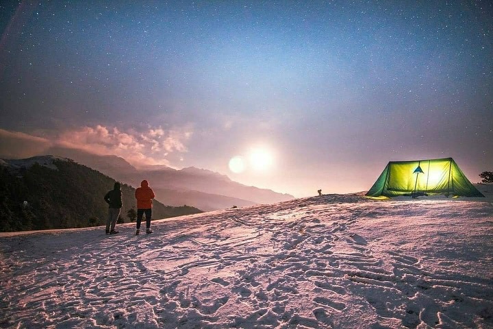
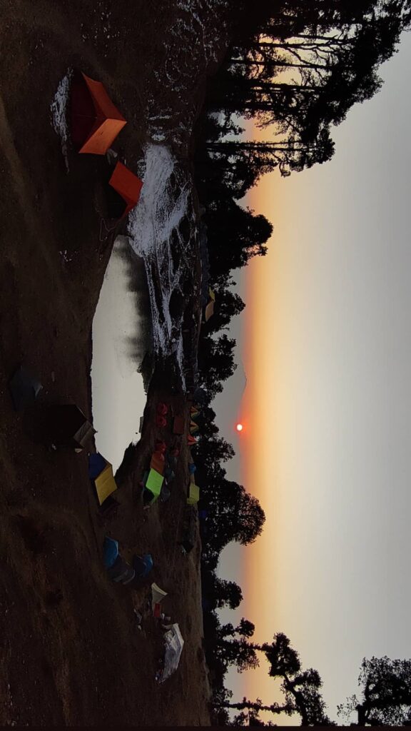
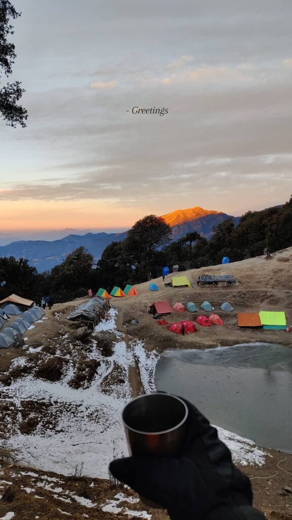
- There are camping sites available at both Jhandi Top and Brahmatal. Many trekkers choose to camp overnight at Brahmatal to experience the tranquility of the alpine lake and the stunning views of the surrounding peaks.
Route View and Map:
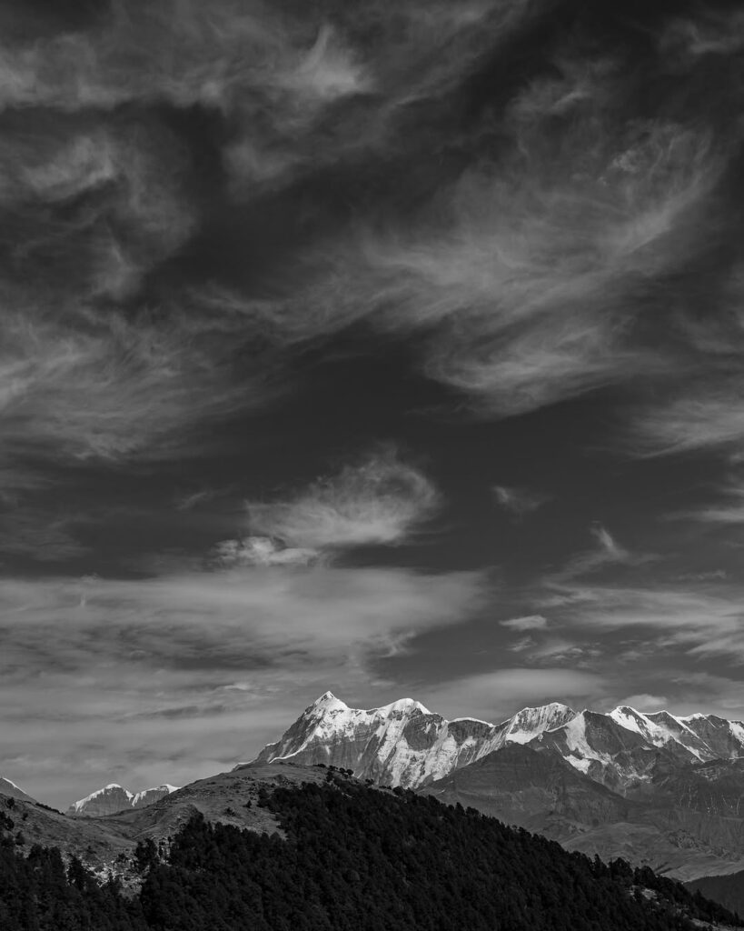
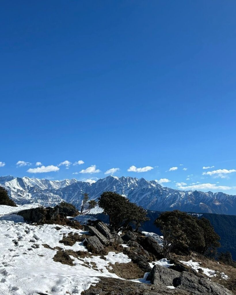
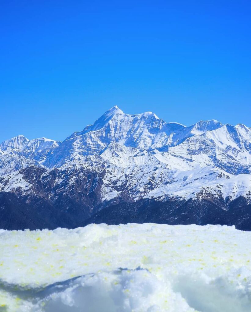
- View: The trek offers breathtaking views of the Himalayan peaks, including Trishul, Nanda Ghunti, Chaukhamba, and more. You’ll also encounter pristine alpine lakes, dense forests, and meadows along the way.
- Map: Detailed topographic maps of the region can usually be obtained from local trekking agencies or tourist information centers. Additionally, there are trekking guidebooks and online resources that provide maps of the route.
Location:
- Bekaltal: Bekaltal is situated at an altitude of around 3,050 meters (approximately 10,006 feet) above sea level.
- Jhandi Top: Jhandi Top is a high point along the trek route, offering panoramic views of the Himalayan ranges.
- Brahmatal: Brahmatal is known for its pristine alpine lake, situated at an altitude of around 3,400 meters (approximately 11,155 feet) above sea level.
Before embarking on the trek, ensure you have proper gear, including trekking shoes, warm clothing, sufficient food and water, and emergency supplies. Additionally, it’s recommended to check weather forecasts and trail conditions beforehand, especially during the monsoon season or winter months when the region experiences snowfal
Trek Distance- 06 km – 6/7 Hours journey
Mode of journey – On foot
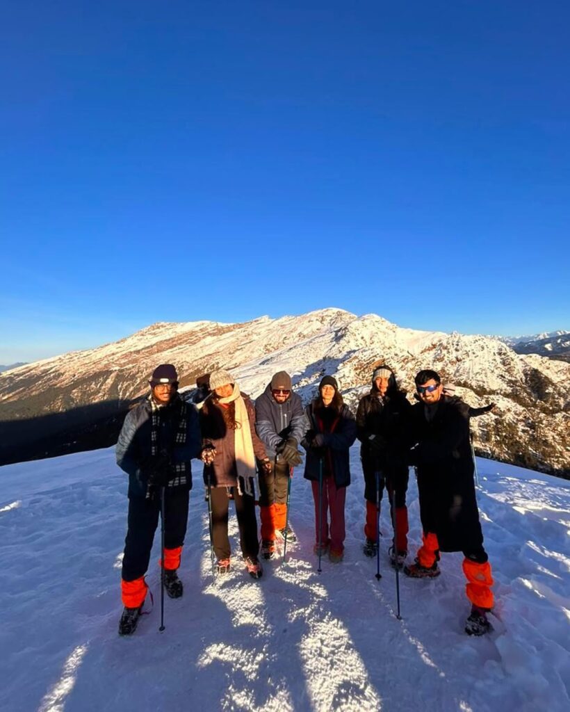
Altitude – – Brahmatal Summit – 3774 Meter
Night Stay – Camp site – on twin share basis
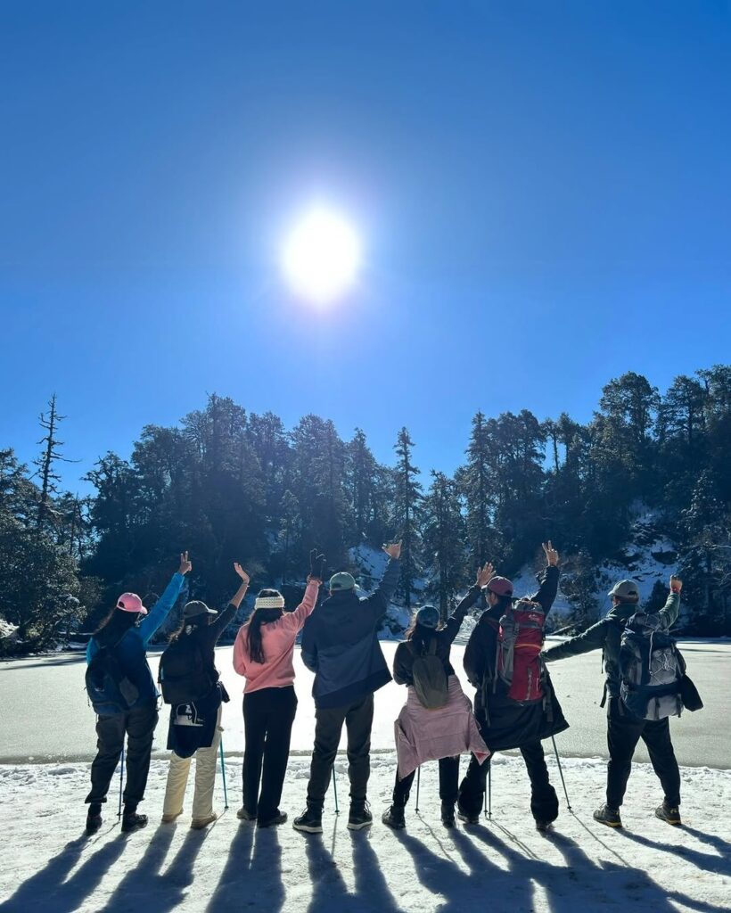
Exploring from Brahmatal Top Summit base camp of brhamatal is an exhilarating part of the trek, offering stunning views and diverse terrain. Here’s an overview of this leg of the journey:
Route Overview:
- Starting Point: Brahmatal Top Summit (3,774 meters)
- Destination: Base Camp
- Distance: Approximately 5 kilometers
- Duration: 6-7 hours, depending on individual pace and conditions
- Difficulty: Moderate to challenging
Route Description:
- Brahmatal Top Summit: Begin your day by summiting Brahmatal Top, which offers breathtaking panoramic views of the surrounding Himalayan peaks, including Nanda Ghunti, Trishul, Chaukhamba, and others. Take some time to soak in the scenery and capture memorable photographs.
- Descent from Brahmatal Top: Descend from the summit, following the trail that leads downwards. The descent may involve navigating through rocky terrain, so proceed with caution.
- Trail towards Brhamatal base Camp: As you descend from Brahmatal Top, the trail will lead you through pristine alpine forests, meadows, and possibly some sections of open terrain. Keep following the well-marked path towards base Camp.
- Arrival at brahmatal Camp: Daldum Camp offers a serene setting amidst the mountains, providing trekkers with a picturesque camping spot. Set up your camp and relax after a day of exploration and trekking.
View and Route:
- View: Along the route, you’ll be treated to stunning vistas of the Himalayan peaks, dense forests, and alpine meadows. The panoramic views from Brahmatal Top are particularly breathtaking, making it a highlight of the trek.
- Route: The route is well-marked, but it’s advisable to have a local guide or a good map for navigation, especially in case of any trail diversions or obstacles.
Best Trek:
- Brahmatal Trek is often regarded as one of the best treks in the Uttarakhand region, offering a perfect blend of natural beauty, adventure, and serenity. The trek takes you through dense forests, picturesque meadows, and alongside pristine alpine lakes, culminating in stunning views from Brahmatal Top. It’s a great choice for both beginners and experienced trekkers.
Before embarking on this trek, ensure you have proper gear, including trekking shoes, warm clothing, sufficient food and water, and emergency supplies. Additionally, always check weather forecasts and trail conditions beforehand, and consider hiring a local guide for added safety and navigation assistance.
Trek Distance 08 km –5/6 Hours journey
Mode of journey – On foot
Altitude – Lohajung – 2316 Meter
The trek from Daldum Camp to Lohajung typically marks the end of the Brahmatal Trek. Here’s an overview of this segment of the journey:
Route Overview:
- Starting Point: Brahmatal base Camp
- Destination: Lohajung
- Distance: Approximately 08 kilometers
- Duration: Typically takes 3-4 hours, depending on individual pace and conditions
- Difficulty: Moderate
Route Description:
- Departure from Brahmatal base Camp: Leave brahmatal Camp in the morning, heading towards Lohajung. The initial part of the trail may involve descending through forests and meadows, depending on the specific location of Daldum Camp.
- Arrival at Lohajung: As you approach Lohajung, the landscape may open up, offering views of the surrounding mountains and valleys. Lohajung serves as a common base for several treks in the region, and upon arrival, you’ll have the opportunity to rest, unwind, and reflect on your trekking experience.
View and Route:
- View: Throughout the trek from via Daldum to Lohajung, you may enjoy scenic views of the Himalayan peaks, lush forests, and charming villages. Depending on weather conditions, you may also catch glimpses of local flora and fauna along the way.
- Route: The route is generally well-marked, but it’s advisable to have a local guide or a good map for navigation, especially in case of any trail diversions or obstacles.
Considerations:
- Weather: Always check weather forecasts before embarking on the trek, as conditions can change rapidly in mountainous regions.
- Supplies: Ensure you have an adequate supply of water, snacks, and any necessary gear for the trek.
- Safety: Trekking in the mountains requires caution. Stay on designated trails, be mindful of your surroundings, and avoid trekking alone if possible.
The trek from Brhamatal base Camp to Lohajung offers a memorable conclusion to the Brahmatal Trek, allowing trekkers to soak in the natural beauty and serenity of the Uttarakhand region.
Total distance 290 km – 9/10 Hours journey
Mode of journey – By taxi
The drive from Lohajung to Dehradun covers a considerable distance through the mountainous terrain of Uttarakhand. Here’s a general overview of the route:
Route Overview:
- Starting Point: Lohajung
- Destination: Dehradun via rishikesh
- Distance: Approximately 290 kilometers
- Duration: Depending on road conditions and traffic, the drive typically takes around 10-12 hours.
Route Description:
- Lohajung to Karnaprayag: The initial part of the journey involves driving from Lohajung to Karnaprayag, a small town situated at the confluence of the Alaknanda and Pindar rivers. This leg of the journey may take around 4-5 hours, covering approximately 110-120 kilometers.
- Karnaprayag to Rudraprayag: From Karnaprayag, continue driving towards Rudraprayag, another significant town in the region located at the confluence of the Alaknanda and Mandakini rivers. This stretch of the journey is around 60-70 kilometers and may take 2-3 hours.
- Rudraprayag to Devprayag: Proceed from Rudraprayag towards Devprayag, where the Alaknanda and Bhagirathi rivers merge to form the Ganges. This part of the journey covers approximately 70-80 kilometers and may take another 2-3 hours.
- Devprayag to Rishikesh: From Devprayag, continue driving towards Rishikesh, a renowned spiritual and adventure tourism destination. This leg of the journey is around 70-80 kilometers and may take another 2-3 hours.
- Rishikesh to Dehradun: Finally, drive from Rishikesh to Dehradun, the capital city of Uttarakhand. This stretch of the journey covers approximately 45-55 kilometers and may take around 1-2 hours, depending on traffic conditions.
Route View:
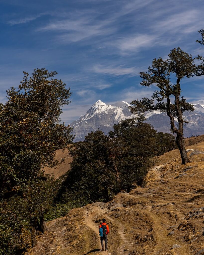
- The route from Lohajung to Dehradun offers breathtaking views of the Himalayan mountains, lush forests, and picturesque river valleys. You’ll pass through several towns and villages, providing glimpses of local life and culture along the way.
Road Conditions:
- While some sections of the route are well-maintained highways, others may be narrower mountain roads with sharp turns and steep inclines. Exercise caution while driving, especially during adverse weather conditions.
Considerations:
- Travel Time: The estimated travel time provided here is approximate and may vary depending on factors such as road conditions, traffic, and weather.
- Rest Stops: Plan for rest stops along the way to stretch your legs, refuel, and grab refreshments.
- Navigation: While the route is generally straightforward, it’s advisable to have a GPS navigation system or maps to assist with directions, especially in remote areas.
Mandatory Documents
Please carry the documents given below
- Original and photocopy of government photo identity card- (Aadhar Card, Driving License, Voters ID, etc,
- Passport and Visa important to foreigners
- Medical Certificate (First part should be filled by the Doctor and Second part by the Trekker)
- Declaration Certificates
What is Included In This Trek?
Transport from Shimla to Shimla Pickup and Drop both way
Forest Permit and entrance fee
Accommodation in tents on twin share basis
Meals: Breakfast, Lunch, Tea, Coffee, Snacks, Soup and Dinner
High quality Dome Tents
Sleeping bags
Mattress