

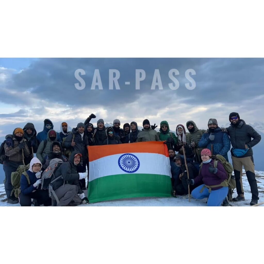
The Sar Pass Trek is a popular trekking route in the Parvati Valley of Himachal Kasol – India -2025-
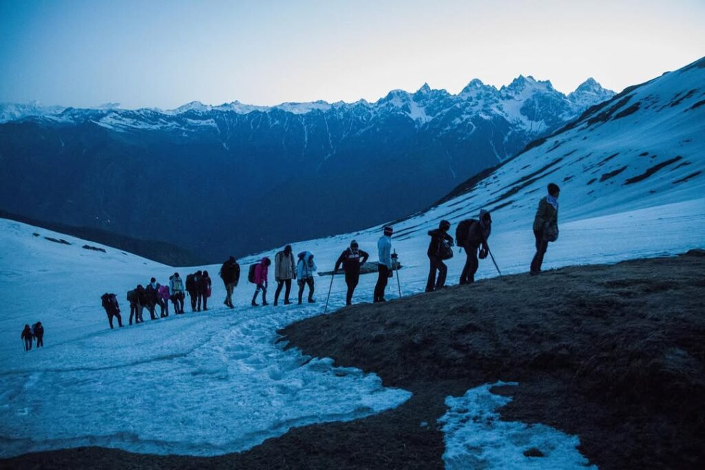
Sar Pass Trek is a stunning trek from Grahan village ending in Barhseini in Kullu Valley. The trek is recommended for all those who love adventure, snowy landscapes, and high mountains.
The trek starts from Kasol where you will PASS through pine forests, magnificent meadows, snow-capped mountains, and some of the most jaw-dropping landscapes which make Sar Pass one of the best treks for beginners. You will also PASS by a frozen lake (Called Sar in the local dialect) from where it got its name.
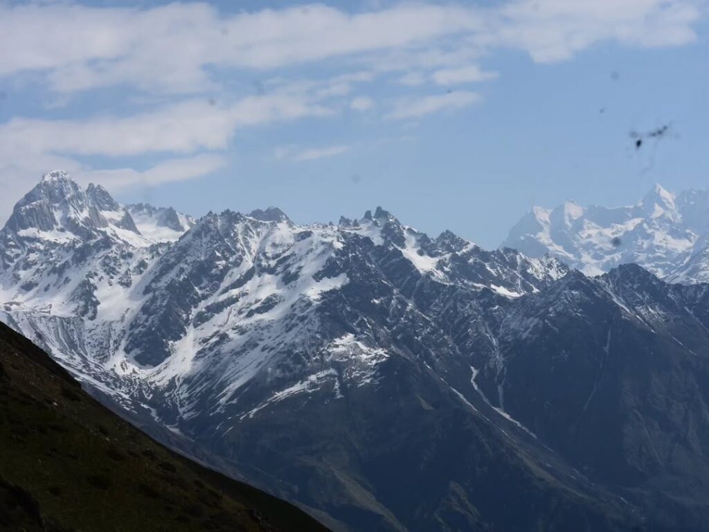
The total trek distance is 37 km. Once you reach the PASS almost close to 14,000ft, the view from the PASS is absolutely breathtaking because of the majestic mountains of Parvati Valley.
Itinerary
Route:
- Starting Point: Kasol Bus Stand Base Camp of H.H
- Destination: Grahan Village
- Distance: Approximately 07 kilometers
- Time Required: Around 4-6 hours, depending on your pace and breaks
- Difficulty Level: Moderate
Trek Details:
- Pickup from Kasol Bus Stand Himalayan Hikers Camp:
- Kasol is well-connected by road, and you can easily reach there by bus or taxi from nearby towns like Bhuntar or Manali. Once you arrive at Kasol Bus Stand, you can start your trek.
- Trekking to Grahan Village:
- The trail starts from Kasol and leads towards Grahan Village. You’ll need to cross the Parvati River and then start ascending through dense forests.
- The initial part of the trek involves a gradual ascent through the forest, with occasional steep sections.
- The trail is well-marked, but it’s recommended to have a local guide or a map with you.
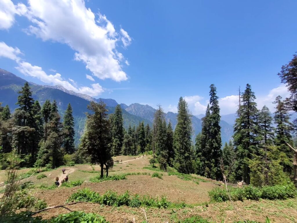
- As you ascend, you’ll pass through lush greenery, pine forests, and possibly encounter some streams.
- After a few hours of trekking, you’ll reach the beautiful Grahan Village, situated at an altitude of around 7,700 feet above sea level.
- Grahan Village is a quaint Himalayan hamlet, offering stunning views of the surrounding peaks and valleys.
- Difficulty Level:
- The trek from Kasol to Grahan Village is considered moderate in difficulty.
- While the trail is well-defined, there are some steep sections, especially during the ascent.
- Proper trekking gear, including sturdy hiking shoes, water, snacks, and a rain jacket (depending on the weather), is recommended.
- It’s also essential to pace yourself and take regular breaks, especially if you’re not used to hiking at higher altitudes.
- Important Tips:
- Start your trek early in the morning to make the most of daylight hours and avoid trekking in the dark.
- Carry an adequate amount of water and snacks to keep yourself hydrated and energized throughout the trek.
- Respect the local culture and environment. Avoid littering and follow the principles of Leave No Trace.
- Check the weather forecast before starting your trek and be prepared for changes in weather conditions.
Route:
- Starting Point: Grahan Village
- Destination: Mini Thatch
- Distance: Approximately 7-8 kilometers
- Time Required: Around 4-5 hours, depending on your pace and breaks
- Difficulty Level: Moderate
Trek Details:
- Starting from Grahan Village:
- From Grahan Village, head towards the trail leading to Mini Thatch. You’ll find signposts or locals who can guide you in the right direction.
- The trail initially ascends through dense forests, similar to the previous segment from Kasol to Grahan.
- You’ll pass through scenic landscapes, lush greenery, and possibly encounter some streams along the way.
- Ascend to Mini Thatch:
- The trek involves a significant ascent as you make your way towards Mini Thatch.
- The trail may become steeper and more challenging compared to the previous segment. Be prepared for some strenuous sections.
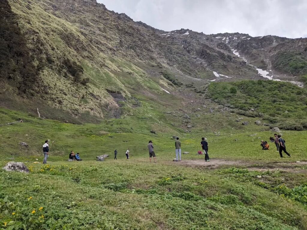
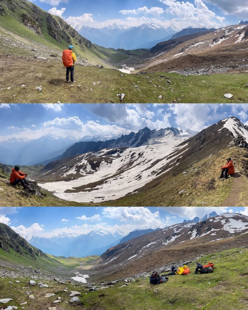
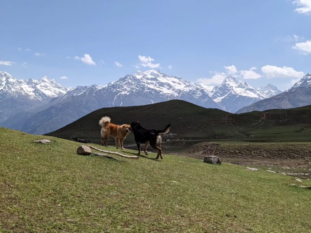
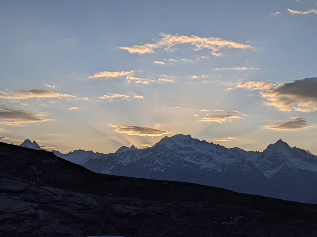
- As you climb higher, you’ll be rewarded with breathtaking views of the surrounding valleys and snow-capped peaks.
- Mini Thatch is a beautiful meadow nestled amidst the mountains, offering a tranquil setting for camping or resting.
- Difficulty Level:
- The trek from Grahan to Mini Thatch is considered moderate to difficult, primarily due to the steep ascent.
- You’ll need to have a good level of fitness and stamina to tackle the uphill sections.
- Proper trekking gear, including sturdy hiking shoes, trekking poles (if required), water, snacks, and warm clothing, is essential.
- Take regular breaks to catch your breath and enjoy the scenery along the way.
- Important Tips:
- Start early in the morning to make the most of daylight hours and avoid trekking in the dark.
- Carry sufficient water and snacks to keep yourself hydrated and energized during the trek.
- Be mindful of your surroundings and follow the trail markers or ask locals for directions if needed.
- Take precautions against altitude sickness, especially if you’re ascending to higher elevations.
- Respect the local environment and leave no trace of your visit.
Trekking from Grahan Village to Mini Thatch offers a challenging yet rewarding experience amidst the natural beauty of the Himalayas. Enjoy the journey and embrace the serenity of the mountai
Trekking from Mini Thatch to Nagaru is a segment that takes you further into the scenic landscapes of the Parvati Valley, eventually leading you to the base camp for the Sar Pass trek. Here’s a guide for this part of your journey:
Route:
- Starting Point: Mini Thatch
- Destination: Nagaru
- Distance: Approximately 5-6 kilometers
- Time Required: Around 3-4 hours, depending on your pace and breaks
- Difficulty Level: Moderate to Difficult
Trek Details:
- Beginning from Mini Thatch:
- Depart from Mini Thatch and follow the trail towards Nagaru. The route may be marked with signs or cairns, but it’s advisable to have a local guide or a map to navigate effectively.
- The initial part of the trek involves ascending further through alpine meadows and possibly rocky terrain.
- You’ll continue to enjoy panoramic views of the surrounding mountains and valleys as you gain altitude.
- Ascent to Nagaru:
- The trail gradually becomes steeper as you ascend towards Nagaru.
- You may encounter some challenging sections with rocky paths and uneven terrain.
- It’s essential to pace yourself and take regular breaks, especially considering the altitude gain.
- Keep an eye out for any trail markers or signs to ensure you’re on the right path.
- Views and Landscape:
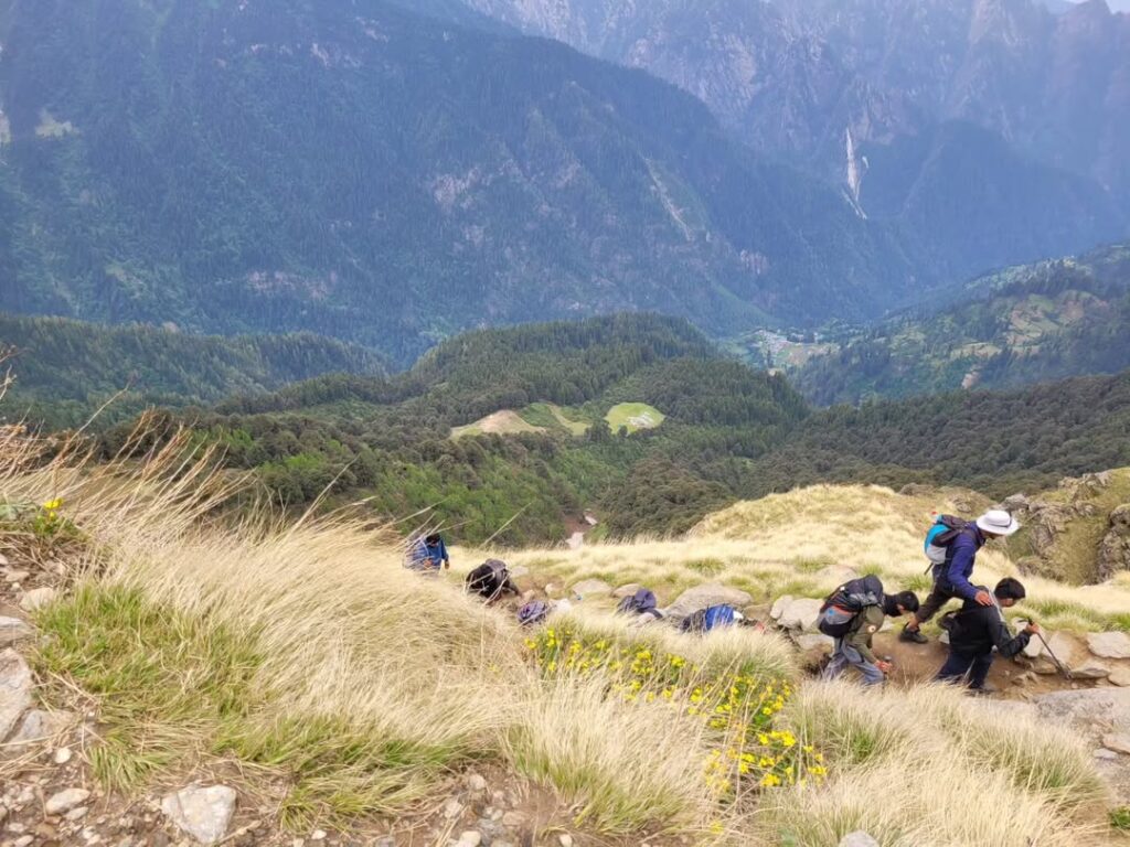
- Along the way, you’ll be treated to stunning views of the Parvati Valley below and the towering peaks surrounding you.
- Nagaru itself is situated at a higher altitude, offering breathtaking vistas of the Himalayan landscape.
- Difficulty Level:
- The trek from Mini Thatch to Nagaru is considered moderate to difficult, primarily due to the steep ascent and potentially challenging terrain.
- Altitude gain can also be a factor, so it’s essential to acclimatize properly and be prepared for the effects of high altitude.
- Ensure you have the necessary trekking gear, including sturdy hiking shoes, warm clothing, water, snacks, and a first aid kit.
- Important Tips:
- Start early in the day to make the most of daylight hours and avoid trekking in the dark, especially considering the terrain’s difficulty.
- Stay hydrated and fuel yourself with snacks to maintain energy levels throughout the trek.
- Keep an eye on weather conditions, as they can change rapidly in mountainous regions.
- Follow Leave No Trace principles and respect the environment and local communities.
Trekking from Nagaru to Sar Pass and then descending to Biskeri Thatch is one of the most exhilarating segments of the Sar Pass trek, offering breathtaking views and a sense of accomplishment as you traverse high-altitude landscapes. Here’s a guide for this challenging yet rewarding trek:
Route:
- Starting Point: Nagaru
- Destination: Biskeri Thatch via Sar Pass
- Distance: Approximately 12-13 kilometers
- Time Required: Around 8-10 hours, depending on your pace and breaks
- Difficulty Level: Difficult
Trek Details:
- Setting out from Nagaru:
- Begin your trek from Nagaru, situated at a considerable altitude. Ensure you’re properly acclimatized before embarking on this challenging segment.
- The initial part of the trek involves ascending towards Sar Pass. The trail is likely to be steep and rocky, requiring careful footing and endurance.
- Ascending to Sar Pass:
- As you ascend towards Sar Pass, the trail may become progressively steeper and more challenging.
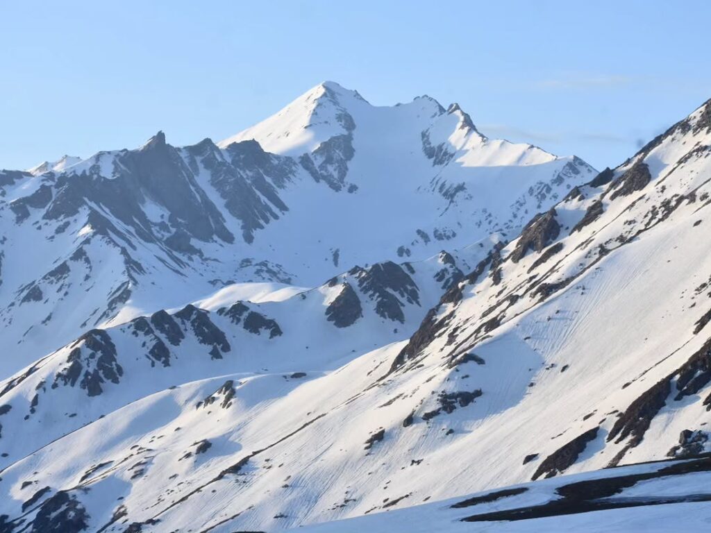
- You’ll navigate through rugged terrain, possibly encountering snowfields or icy patches, depending on the season.
- Keep an eye out for trail markers or follow the guidance of your guide to stay on track.
- Sar Pass, situated at an elevation of around 13,800 feet, offers breathtaking views of the surrounding peaks and valleys, making the ascent worth the effort.
- Crossing Sar Pass:
- Once you reach Sar Pass, take some time to rest and soak in the stunning vistas before beginning your descent towards Biskeri Thatch.
- The descent from Sar Pass to Biskeri Thatch can be equally challenging, with steep gradients and potentially slippery terrain. Use trekking poles for stability if necessary.
- Descending to Biskeri Thatch:
- The trail from Sar Pass descends through alpine meadows and forests, providing a contrast to the rugged terrain of the ascent.
- While the descent may be less physically demanding than the ascent, it requires caution to navigate safely, especially on uneven terrain.
- Biskeri Thatch, nestled amidst the mountains, offers a serene camping spot to rest and rejuvenate after the day’s trek.
- Difficulty Level:
- The trek from Nagaru to Sar Pass and then to Biskeri Thatch is considered difficult, primarily due to the steep ascent, high altitude, and potentially challenging terrain.
- Proper acclimatization, physical fitness, and trekking experience are essential prerequisites for this segment.
- Ensure you have the necessary equipment, including sturdy hiking shoes, warm clothing, trekking poles, water, snacks, and a first aid kit.
- Important Tips:
- Start early in the day to allow ample time for the trek and to avoid trekking in low visibility conditions, especially during the descent.
- Stay hydrated and nourished throughout the trek to maintain energy levels.
- Keep a close watch on weather conditions and be prepared for changes in mountain weather.
- Follow Leave No Trace principles and respect the environment and local culture during your trek.
Trekking from Biskeri Thatch to Pulga Road offers a scenic route through the picturesque landscapes of the Parvati Valley. Here’s a guide for this segment of your trek:
Route:
- Starting Point: Biskeri Thatch
- Destination: Pulga Road
- Distance: Approximately 10 kilometers
- Time Required: Around 5/6 hours, depending on your pace and breaks
- Difficulty Level: Moderate
Trek Details:
- Departing from Biskeri Thatch:
- Begin your trek from Biskeri Thatch, situated amidst the mountains and alpine meadows.
- The trail initially descends from Biskeri Thatch, gradually leading you towards lower elevations.
- Scenic Views along the Way:
- As you descend, you’ll be treated to breathtaking views of the surrounding valleys, lush forests, and distant peaks.
- The trail winds its way through forests, meadows, and possibly small streams, offering a varied and picturesque landscape.
- Traversing through Villages:
- Along the route, you may pass through or encounter several small villages inhabited by the locals.
- These villages provide a glimpse into the local way of life and may offer opportunities to interact with the residents.
- Navigating the Trail:
- While the trail is generally well-defined, it’s advisable to have a map or GPS device to ensure you’re on the right path.
- Signposts or markers may guide you along the way, but it’s always helpful to ask locals for directions if needed.
- Trekking Level:
- The trek from Biskeri Thatch to Pulga Road is considered moderate in difficulty.
- While the overall terrain may involve some descents and ascents, it’s generally less challenging compared to higher altitude treks.
- However, be prepared for uneven terrain, rocky sections, and possibly some steep gradients, particularly as you descend towards Pulga Road.
- Important Tips:
- Start your trek early in the day to make the most of daylight hours and avoid trekking in the dark.
- Carry sufficient water, snacks, and any necessary supplies for the trek.
- Wear sturdy hiking shoes and comfortable clothing suitable for trekking.
- Respect the environment and local communities along the way, and adhere to Leave No Trace principles.
- Check the weather forecast before setting out and be prepared for changes in weather conditions.
- The route from Pulga to Kasol involves driving back along the road you trekked on or taking any alternate routes available. The primary road network connects these two destinations.
- Distance:
- The distance between Pulga and Kasol by road is approximately 15-20 kilometers, depending on the specific route you take.
- Road Conditions:
- The road conditions can vary, but in general, the roads in this region are narrow and winding, often with steep inclines and declines.
- Some sections of the road may be rough or unpaved, especially in more remote areas.
- Driving Time:
- The driving time from Pulga to Kasol typically ranges from 30 minutes to an hour, depending on traffic, road conditions, and the specific route taken.
- Scenic Views:
- The drive from Pulga to Kasol offers stunning views of the surrounding mountains, valleys, and forests. Be sure to take some breaks along the way to admire the scenery and take photographs.
Mandatory Documents
Please carry the documents given below
- Original and photocopy of government photo identity card- (Aadhar Card, Driving License, Voters ID, etc,
- Passport and Visa important to foreigners
- Medical Certificate (First part should be filled by the Doctor and Second part by the Trekker)
- Declaration Certificates
What is Included In This Trek?
Transport from Shimla to Shimla Pickup and Drop both way
Forest Permit and entrance fee
Accommodation in tents on twin share basis
Meals: Breakfast, Lunch, Tea, Coffee, Snacks, Soup and Dinner
High quality Dome Tents
Sleeping bags
Mattress